
Get ready for a cloudy, rainy, and chilly Sunday. Yes, you guessed it right—we’re talking about cold air damming, or as some might call it, the “wedge.” But what does this really mean? Well, cold air damming occurs when a dense, cold air mass wedges itself against the eastern side of the Appalachian Mountains, creating a metaphorical dam that stubbornly resists the warm air trying to make its way into the CSRA.
Impacts on CSRA Weather
- Temperature Inversions: Cold air damming leads to the formation of temperature inversions, where a layer of warm air aloft traps cooler air at the surface. This inversion causes temperatures at ground level to remain cooler than usual.
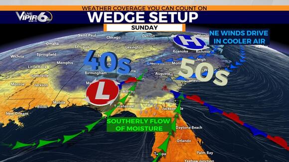
- Temperature Gradients: The CSRA may experience significant temperature gradients across the region during cold air damming events. Areas under the influence of the cold wedge can have substantially cooler temperatures than locations farther south.
- Cloud Cover: Cold Air Damming often results in persistent cloud cover due to the trapped cold air.
- Precipitation: With the wedge setup we are seeing on Sunday, precipitation will come in the form of rain. If it were colder at the surface, then rain, sleet, or snow could occur.
- Duration and Frequency: Cold air damming events in the CSRA can vary in duration and frequency. The setup we are dealing with won’t last long.