
DISCUSSION
Scattered thundershowers will remain possible through this evening.
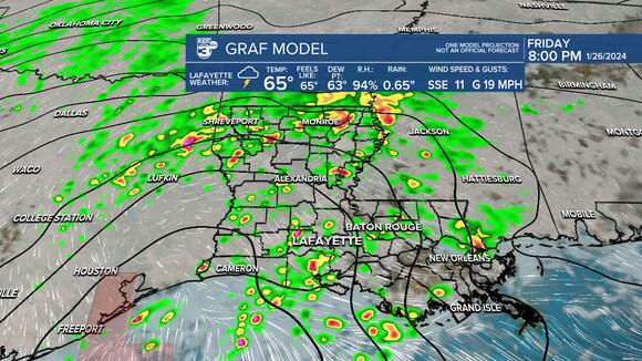 Friday pm
A line of storms will work in after midnight with our cold front.
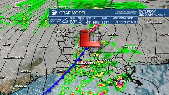 Friday pm
A marginal risk (level 1) of severe storms exists for Acadiana thru tonight.
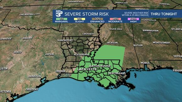 Friday pm
An additional 1-2″+ will be possible.
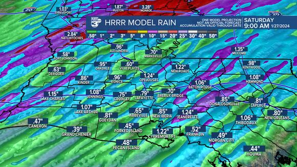 Friday pm
All of the rain will kick out here prior to daybreak Saturday although mostly cloudy skies will remain.
Expect highs to settle into the mid-60s.
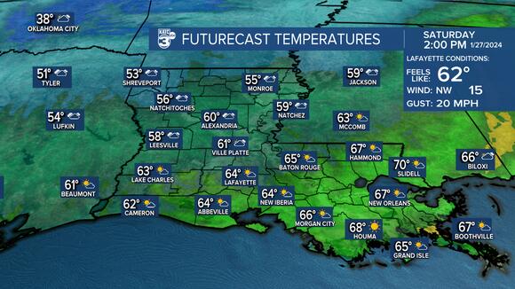 high temperatures
Breezy WNW winds will come in at around 8-16mph.
Heading for the low-mid 40s Saturday night into Sunday morning.
Some leftover clouds Sunday morning should hopefully yield to mostly sunny skies Sunday afternoon as highs only reach the mid-50s.
Much of next week will feature seasonable and dry conditions with highs in the 60s and lows in the 40s.
Have a good weekend!
————————————————————
Stay in touch with us anytime, anywhere.
To reach the newsroom or report a typo/correction, click HERE .