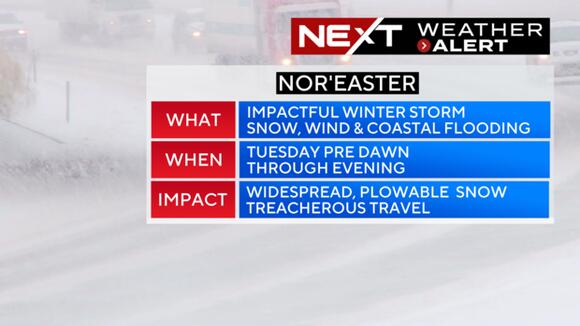
BOSTON – The WBZ Weather Team has issued a NEXT Weather Alert for a highly impactful nor’easter headed our way on Tuesday.

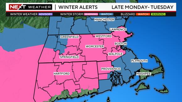
The National Weather Service has also issued winter storm warnings for most of interior Massachusetts.

Winter is about to make a serious comeback. After a record-breaking warm weekend and a rampant spread of spring fever, we now turn our attention to an approaching winter storm.
Timeline of Tuesday’s storm
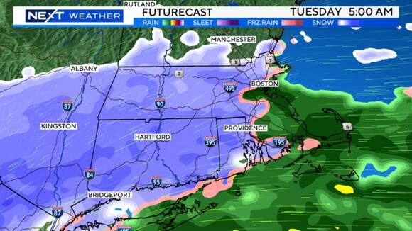
The precipitation arrives after midnight on Monday. Surface temperatures will initially be rather mild, so it will likely start as rain across far eastern and southeastern Massachusetts. By 5 a.m., it will be snowing across most of southern New England with rain gradually changing to wet snow along the immediate coastline.

Once the rain changes to snow, it will come down very heavily on Tuesday morning. The brunt of the storm and majority of the snow accumulation will occur between 7 a.m. and 4 p.m. Tuesday. Snowfall rates of 1-2 inches per hour are likely in some of the heavier bands that develop. Highways will quickly become snow-covered, and travel will be quite slippery/treacherous during both the Tuesday AM and PM commutes.

