(PINPOINT WEATHER) — We got a nice break in the rain Friday! What a warmup, too.
The high reached 72 degrees at Charlotte. It didn’t quite beat the record of 75, but it’s about 20 degrees above average for late January. While we won’t be quite as warm over the weekend, highs will still be above the average of 53.
Click here to see our latest Pinpoint Weather forecast! 🌤️🌦️
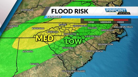
We’ve got more rain on the way, too. The next wave of low pressure will head our way Saturday, spreading in more heavy batches of rain and potentially some severe storms. The severe risk is low, but not zero. It’s one of the reasons Saturday is a Pinpoint Weather Alert Day .
Damaging wind gusts is the main threat, and flooding may develop around some neighborhoods as well.
Sunday is definitely the drier half of the weekend. The exception is in the mountains, where another round of snow will develop. Up to 1-3 inches is possible, with higher amounts up into ski country.

The talk of mountain snow means temperatures will get cooler for next week. It’s back to reality as highs drop back down into the 50s. Next week is brighter, too, with more sunshine. The only mentionable chance of rain and mountain snow will be by mid-week on Wednesday.

