
QUICK-LOOK FORECAST:
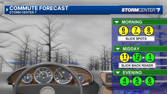
- Colder today, morning flurries
- Sunday begins the thawing out process
- Staying mild into next week
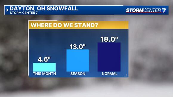
>> RELATED: Accumulating snow expected today; Timing, how much, what to expect
DETAILED FORECAST:
>> TRACK THE LATEST CONDITIONS: Live Doppler 7 Radar
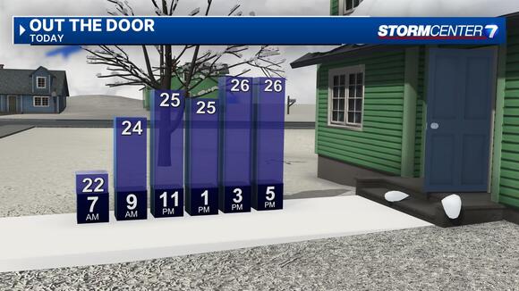
SATURDAY (COLD) : Some clouds and flurries early. Becoming mostly sunny by the afternoon.
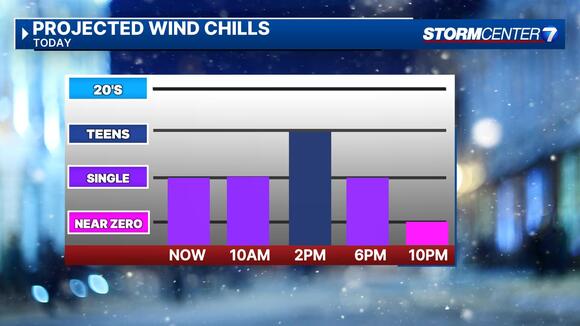
Cold with wind chills in the single digits this morning, and wind chills not improving much this afternoon into the Teens. Breezy with afternoon highs remaining cold in the middle to upper 20s.
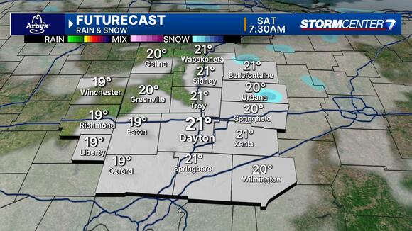
SUNDAY: Another cold start with single digit wind chills before 10AM. Thawing out process begins with a good amount of snow melting. Mostly sunny and chilly with highs in the upper 30s.
MONDAY: Mostly sunny skies and turning milder. Warming it up with highs in the mid 40s.
TUESDAY: Partly sunny and dry. Highs in the lower 50s.
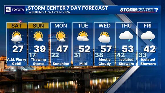
WEDNESDAY: Mostly cloudy with very mild temperatures. Mild with highs in the lower to middle 50s.
THURSDAY: Mostly cloudy with a few showers possible. Remaining mild with highs in the lower 50s.