
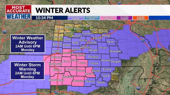
Winter weather alerts blanket Southern Missouri and Northern Arkansas as a winter storm gears up over Oklahoma. Several inches of snow has already fallen in the Oklahoma City area as of late Sunday evening with the first reports of snow of the night beginning to come in from Northwest Arkansas.
Rain will gradually build into Southwest Missouri and Northwest Arkansas with a transition to snow mainly after 3am. Snow, some heavy should be falling over much of Southwest Missouri and Northwest Arkansas by sunrise. The area of snow will shift east across Southern Missouri and Northern Arkansas throughout the day Monday.
There are two keys to the forecast snow. The first is the track of the upper-level low. It looks like the track will be more west to east across Arkansas. This will place the axis of the band of snow from near Bentonville, AR, to West Plains, MO. The heavier snow totals will tend to fall along this line.
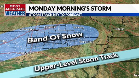
The other key to the forecast is temperature and timing of the snow. It appears that the snow will move in before sunrise over Southwest Missouri and Northwest Arkansas, enhancing snow accumulations. Snow will arrive during the day further east, and this will tend to work against accumulations thanks to warmer temperatures and daylight.