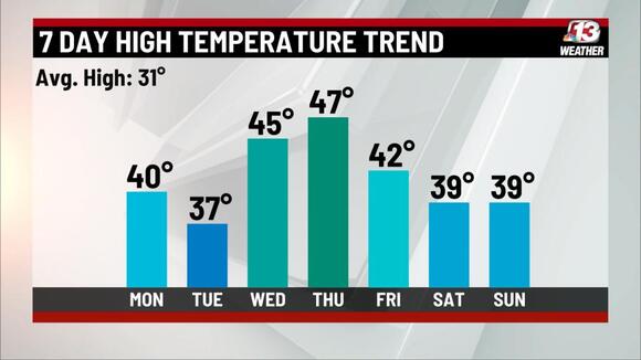
The sun has made a reappearance today in western and parts of central Iowa, raising temperatures into the 40’s in some areas, while the east stayed socked in. Highs tomorrow look pretty nice, given the time of year, as all of us will see some sunshine.
We’ve got a nice trend as we head into the week. Tuesday will be a little cloudier, breezy and a little colder as a weak boundary moves through early.

After that we warm into the mid-to-upper 40’s Wednesday and Thursday. For now, the upcoming weekend looks precipitation-free as any rain or snow looks to stay to our southwest. We’ll need to stay alert on some of these mornings for refreezing of snowmelt.

The 6-to-10 and 8-to-14-day outlooks, below, also appear to present some good news, as highs look to stay above average into the middle of February. Enjoy!


Copyright 2024 Nexstar Media Inc. All rights reserved. This material may not be published, broadcast, rewritten, or redistributed.
For the latest news, weather, sports, and streaming video, head to who13.com.

